Deleted
Deleted Member
Posts: 0
|
Post by Deleted on Jan 29, 2020 16:52:26 GMT -5
By the end of Sixties New Zealand Mount Cook Air Service did regular flights from Hokitika NZHK on South Island to Fox Glacier. It's part of the Southern Alps and is one of the most accessible glaciers in the world. The tallest peak of th Southern Alps is the Aoraki / Mount Cook and the highest point in New Zealand at 3,724 metres (12,218 ft). The region contains over 3,000 glaciers larger than one hectare. Being allways challenged by creating AI flights in mountain areas, I took the opportunity to a HTAI Cessna 172 with textures of Mount Cook Air Service to let it fly from Hokitika to the Fox Glacier. Here some screens: Taking off at Hokitika  On the way over the West Coast 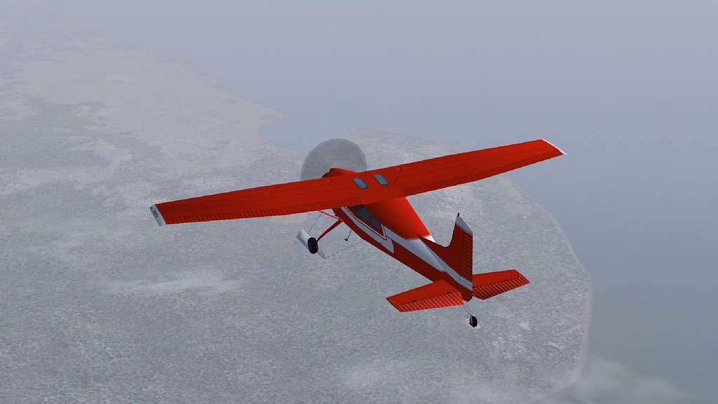 Approaching the Southern Alps with Mount Cook in the background  Ready for landing  Touchdown on the glacier 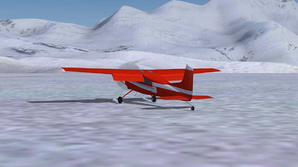 Guests leaving for skiing on the glacier  Take off at Fox Glacier and flying back  An easy flight, as it doesn't hit mountains as most flights in such areas. Bernard |
|
|
|
Post by stansdds on Jan 30, 2020 8:43:22 GMT -5
Well done!
|
|
|
|
Post by aharon on Jan 30, 2020 10:06:59 GMT -5
that is IMPRESSIVE
What waypoints did you use for this flight please??
Regards,
Aharon
|
|
Deleted
Deleted Member
Posts: 0
|
Post by Deleted on Jan 30, 2020 12:40:51 GMT -5
Hi Aharon,
This flight doesn't need any waypoints. It would be an other thing if f.i. the flight would start at Mount Cook Airport NZMC. There arrivals and departures are impossible.
Bernard
|
|
|
|
Post by aharon on Jan 30, 2020 14:25:51 GMT -5
Yeah but you would need waypoints or some guidance to get to landing strip on that mountain Right?
|
|


